Exploring Maps on Episode 3 of the Heartbreak Series
This episode of the Heartbreak series looks at maps, both as material objects and as tools that shape how we see the world we live in. It looks at how maps have been used to divide countries, and how across those same borders they can be used to bring communities together. It takes in the practical implications of map making, such as for refugees who are living in temporary camps, and the romanticised sense of wandering off the beaten path.
It questions the authority of maps, whilst also realising that they can lend this authority to marginalised people. The episode is largely inspired by Lana Čmajčanin’s commissioned work of a ‘war table’ which features 70 layers of historic maps of the Mediterranean that can be moved around and in doing so, question the arbitrariness of borders.
Here to discuss maps is Dr Brian Tomaszewski, a geographic information systems and crisis management academic from RIT, Lucas LaRochelle a multidisciplinary designer and Dr Robert Herian a senior lecturer in law at the Open University.
Overview:
[2:42] Dr Brian Tomaszewski explains how geographic information systems are used during times of crisis, and shares how his project RefuGIS has let refugees in Jordan create those systems themselves.
Dr Tomaszewski is an associate professor at the Rochester Institute of Technology in upstate New York, where he is the director of the centre for Geographic Information Science and Technology. Combined with an interest in crisis management which has seen Brian work in Rwanda, South Sudan and Jordan, over the last four years he has been teaching refugees how to map their surroundings through RefuGIS - a project that has grown significantly since he first came up with the idea. You can read more about the technology behind the project, Esri, and story maps here.
Brian is also the author of a book called Geographic Information Systems for Crisis Management, published in 2014.
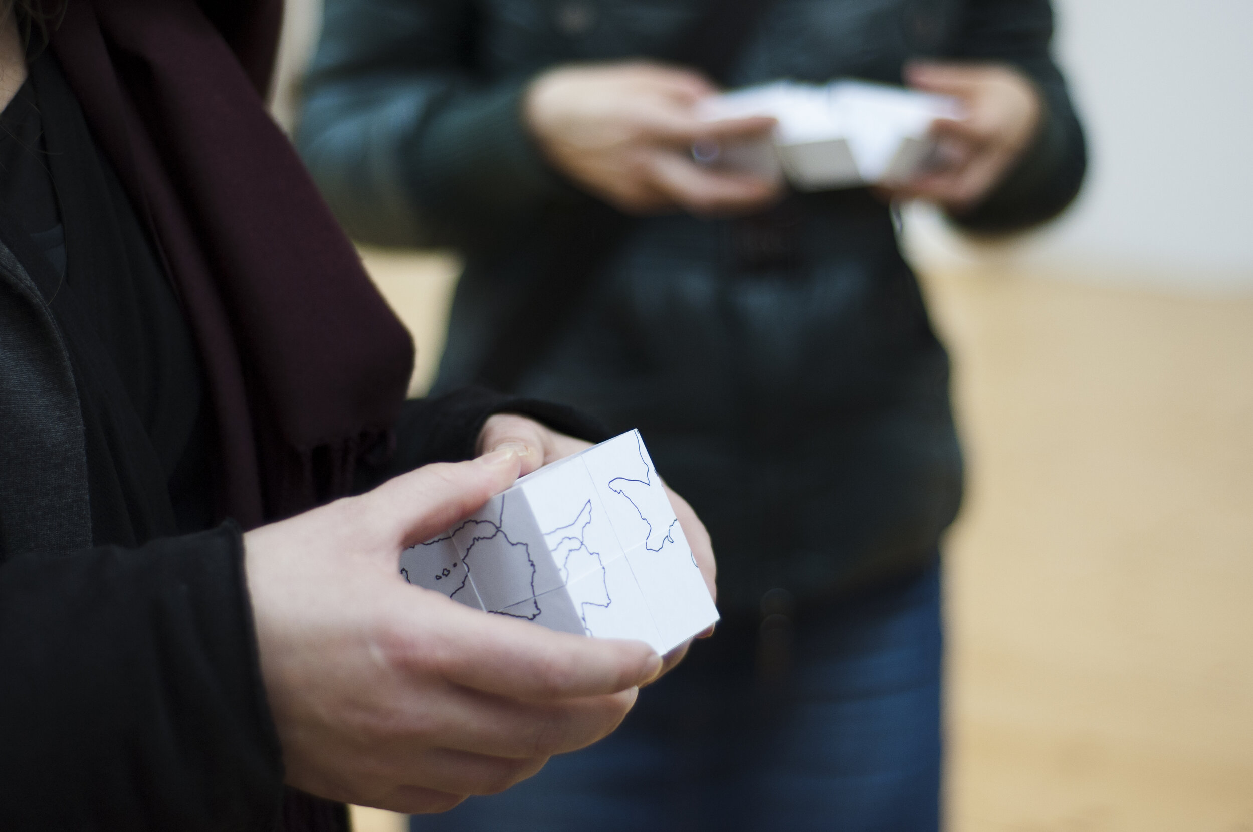
Image: Project Blank Maps: Modular Geography, Interactive modular object, (2014), photo by Elvis Krstulović, courtesy of Lana Čmajčanin.
[13:53] Lucas LaRochelle reveals how the map form can be 'hijacked' to improve visibility for communities, namely the global LGBTQIA+ community that has submitted queer memories to LaRochelle's archiving project 'Queering the Map.'
LaRochelle is a multi-disciplinary designer, artist and researcher. Their work is concerned with queer geographies, critical internet studies and community based archiving. LaRochelle founded and designed Queering the Map, a community generated counter-mapping project that digitally archives queer experience in relation to physical space.
The online map-cum-archive received an Honorary Mention for the 2018 Prix Ars Electronica, and is included in the Library of Congress LGBTQ+ Studies Web Archive. Read an article on the project by Angad Singh for Ruthless Magazine here.
[20:42] Dr Robert Herian introduces his work on the 'desire line' phenomenon, transforming it from the bounds of urban planning to a methodology that can show socio-political, economic and cultural desires.
Dr Herian is a senior lecturer in Law at the Open University, and has been looking into how our desire for movement, permitted or otherwise, can leave traces on our surroundings. Dr Herian’s research interests have taken in property law, technology and psychology. Most recently, he has been working on the Desire Lines project alongside artist Lucy Atherton, which debuted at Tate Exchange with a film and presentation - available here. An in depth blog on the topic is available here.